3 months ago
61
3 months ago
61

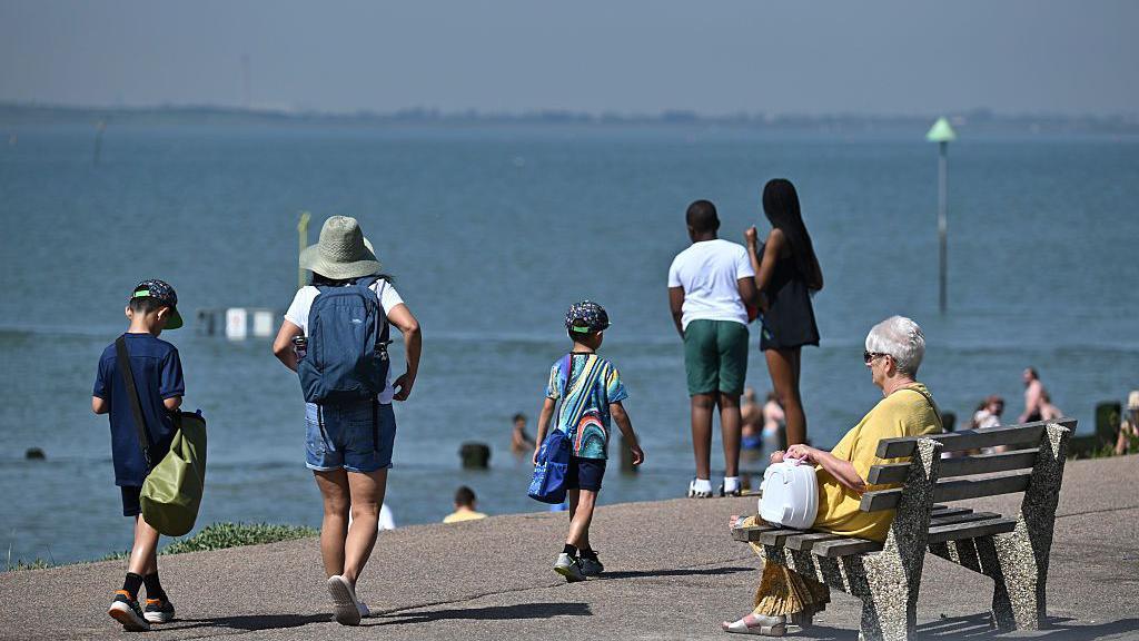 Image source, Getty
Much of the UK experienced soaring temperatures in an early season May heatwave across England and Wales
BySimon King
Lead Weather Presenter
With temperatures hitting a record breaking 35.1C this week, it has been an exceptional May heatwave.
In its build up we saw temperatures increase rapidly - by up to 10C in just two days in some locations.
Historically, it would have been more common to see a gradual increase of a degree or two each day.
The rapid onset from an average to high, even extreme, temperature - or a "heat spike" - is something I and fellow meteorologists have noticed happening more often.
Ed Hawkins, professor of climate science at the University of Reading, told the BBC that "Today's heat events are emerging earlier, intensifying faster and occurring across a much warmer background climate".
While according to Dr Ségolène Berthou from the Met Office, "We can't explicitly say that extreme heat temperatures spike faster now than they did in the past," experts are beginning to piece together a number of other factors that could provide an explanation.
Hotter days give a 'head start'
The Met Office's State of the Climate 2024 report shows that in parts of the UK the hottest days are warming around twice as fast as typical days. Compared with 1961–1990, the number of days 5C above average has doubled, while days 10C above average have quadrupled.
Or as Dr Berthou expresses it: "Extreme temperatures are increasing faster than average temperatures."
Summer daytime highs are already about 1.5C warmer when comparing the 1991-2020 climate period with 1961-1990.
After the UK hit 40.3 C in July 2022, Met Office studies showed the likelihood of exceeding 40C is now more than 20 times higher than in the 1960s.
The higher baseline - or head start - means similar summer weather patterns now reach heatwave and extreme heat thresholds more easily.
Drier ground, drier air – a loaded dice for faster warming
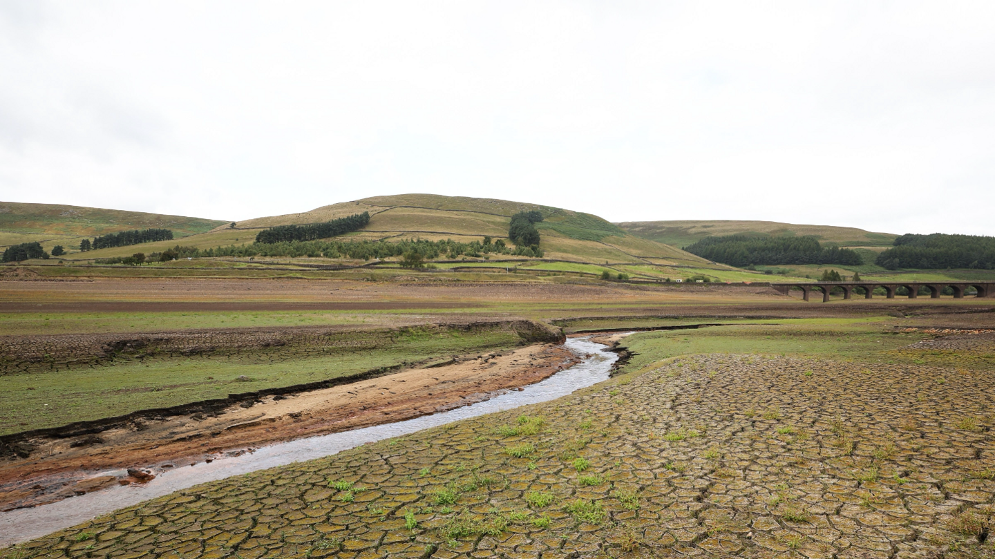 Image source, EPA
Drier ground heats up faster and we are likely to see more frequent droughts drying up reservoirs, such as this in Derbyshire in August 2025
How quickly temperatures rise isn't just about how warm the air starts out, but how dry the land and atmosphere are.
Dry ground heats up faster than moist ground because less energy is used for evaporation and more goes directly into raising temperature.
There is strong evidence that UK summer soils are becoming drier as the climate warms, with Met Office projections showing earlier seasonal drying and more frequent droughts, particularly in southern and eastern England.
The same principle applies higher above the ground. Large, slow‑moving areas of high pressure - often called blocking highs or heatdomes - are large areas of sinking air.
Like squeezing a sponge, the descending motion dries the air out and when you add in the fact the air is compressed, this also adds to the air heating up.
While blocking highs may not be happening more often, studies suggest that when they do occur the heat and dryness they bring are more intense than in the past.
As Professor Sarah Perkins‑Kirkpatrick, climate scientist from the Australian National University puts it: "The dice are loaded for it to be hotter more quickly…as soon as high pressure systems move over, bang, the temperature goes up."
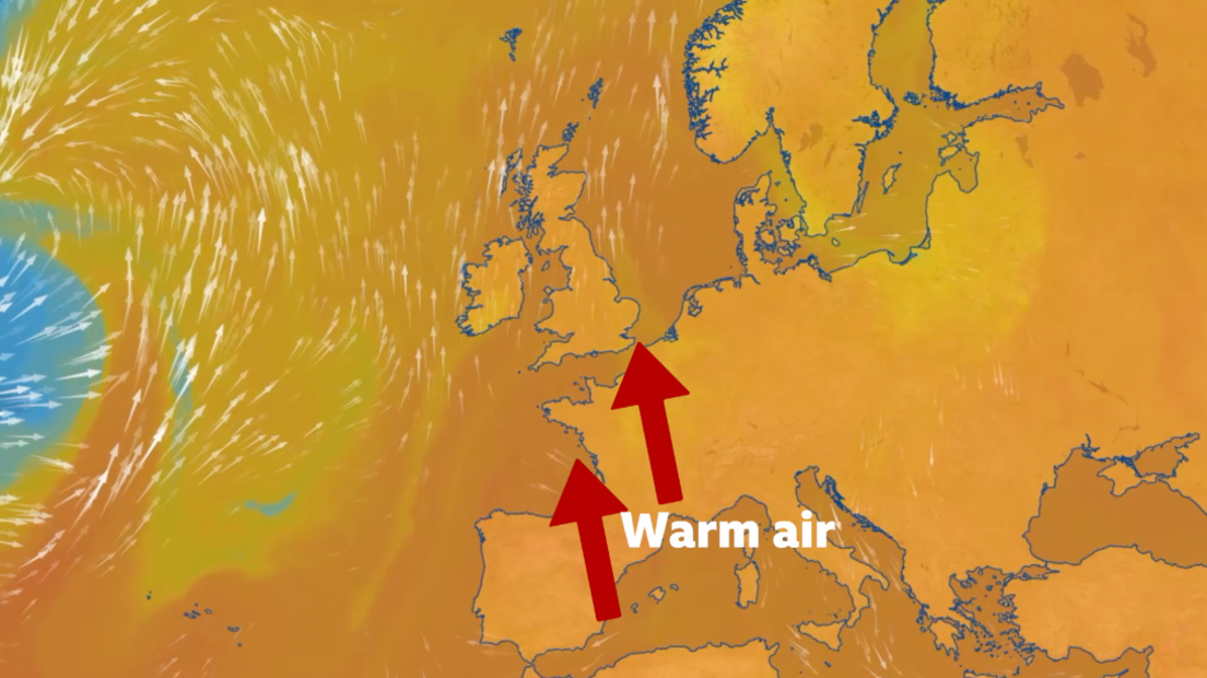
South or south-easterly winds can bring much warmer air from southern Europe and North Africa
The warmest weather in the UK, and when we tend to experience heatwaves in the summer, is when we have a south or south-easterly wind.
It draws in the much warmer air from southern Europe and North Africa.
Europe is warming at around twice the global average, particularly in southern areas where the largest heat extremes occur. With this source region primed with higher temperatures, a more frequent southerly air flow transports it to the UK.
Wind changes can happen quickly in the UK and may explain why in the spring and summer we can go from having average temperatures with a westerly windflow followed a day after by a south or south-easterly wind quickly drawing in hotter air and the onset of a heatwave within a couple of days.
 Image source, Getty
Temperatures in 2023 were boosted significantly by a marine heatwave in the seas around the UK
Sea surface temperatures around the UK may also be a factor.
According to Dr Berthou, "We are seeing more frequent and persistent marine heatwaves in the seas around the UK," and this can influence land temperatures.
In June 2023, London warmed rapidly from 23C on 8 June to 31C by 10 June, coinciding with a period when UK sea surface temperatures were 3–5 C above average.
Combined with a large area of high pressure and light winds, the unusually warm seas allowed the air to pick up extra heat before moving inland.
A study in the scientific journal Nature found this marine heatwave added around 1 C to near‑surface air temperatures over land during June, rising to about 1.5C by the start of July.
June 2023 went on to become the UK's hottest June on record, with mean temperatures 2.5 C above average. The study concluded that around 0.6 C of this warmth was directly linked to the marine heatwave.
With seas around the UK warming by roughly 0.3C per decade, and potentially 2.5C warmer by 2050, this influence is likely to grow.
Are heat spikes dangerous?
Heatwaves kill people. During the summer of 2025, approximately 24,000 people died across Europe due to heatwaves.
The elderly, young and those with health conditions are most at risk of being affected by hot weather, particularly the rapid onset of higher temperatures.
How quickly the body can acclimatise to hotter weather is a factor.
"If you have temperatures going from 20C to above 30C in a short period of time, that's going to hit certain people really, really hard…especially if they don't do anything to acclimatise or adapt," says Prof Perkins-Kirkpatrick.
The body is put under greater strain and is more susceptible to heat exhaustion and heatstroke.
And there is evidence that heat-related mortality risk is highest during the first days of heat exposure before it declines as the body acclimatises.
While there is a perception of heat spikes seemingly becoming more frequent amongst some meteorologists, it needs "further scientific analysis" according to Dr Berthou, to know if the factors discussed lead to peak temperatures being recorded sooner during hot spells.