

 Image source, BBCWeatherWatchers/Nadezna
Daffodils in the Vale of Glamorgan on Thursday. Spring is just around the corner
ByDarren Bett
Lead Weather Presenter
A major change in the UK's weather pattern is heading our way.
The brief spell of cold weather with frost, ice and hill snow is ending, with temperatures set to jump by up to 10C from Friday onwards.
The blocked weather pattern which has been maintaining the recent wintry spell is being pushed away with milder air sticking around for the next week or so.
It will be accompanied by further spells of wet weather coming across from the Atlantic.
Heaviest rain is expected to be over western hills and the ongoing threat of flooding is likely to continue.
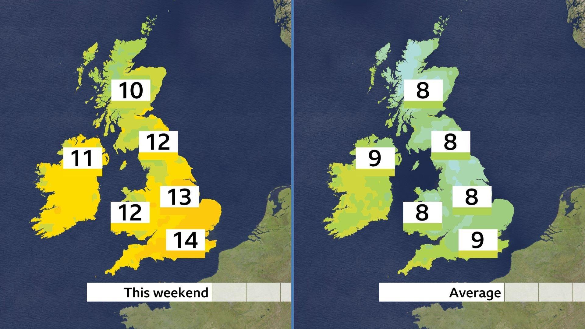
Maximum temperatures this weekend will be higher than the average for mid February
Recent days have seen temperatures typically 4C or 5C (39-41F) by day and as low as minus 9C (16F) in Scotland at night. It also felt colder in the strong south-easterly wind.
The cold air is being pushed away to the east of the UK and a change to south-westerly winds will bring much milder air from the Atlantic.
Daytime temperatures will be 10-14 Celsius (50-57F) in many parts of the country over the weekend and into next week. The risk of frost is much reduced with temperatures at night generally falling to 5-9 Celsius (41-48F).
There has been a stark lack of mild days in Scotland this year, with the start of 2026 marking the longest wait for the temperature to reach 12C (54F) in the country since 1986.
Why such a significant change?
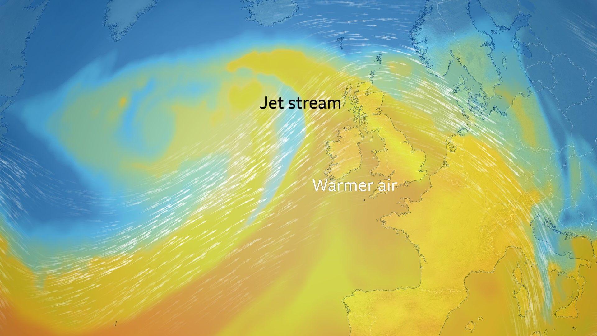
Jet stream further north allowing south-westerly winds to lift temperatures
The cold blocking area of high pressure over Scandinavia that has been in place for much of 2026 so far is being pushed away. That means milder winds can push across the whole of northern Europe more consistently.
The jet stream, which has been positioned across the UK for the last few weeks will move further north at times, keeping the UK in warmer air.
Risk of flooding to continue
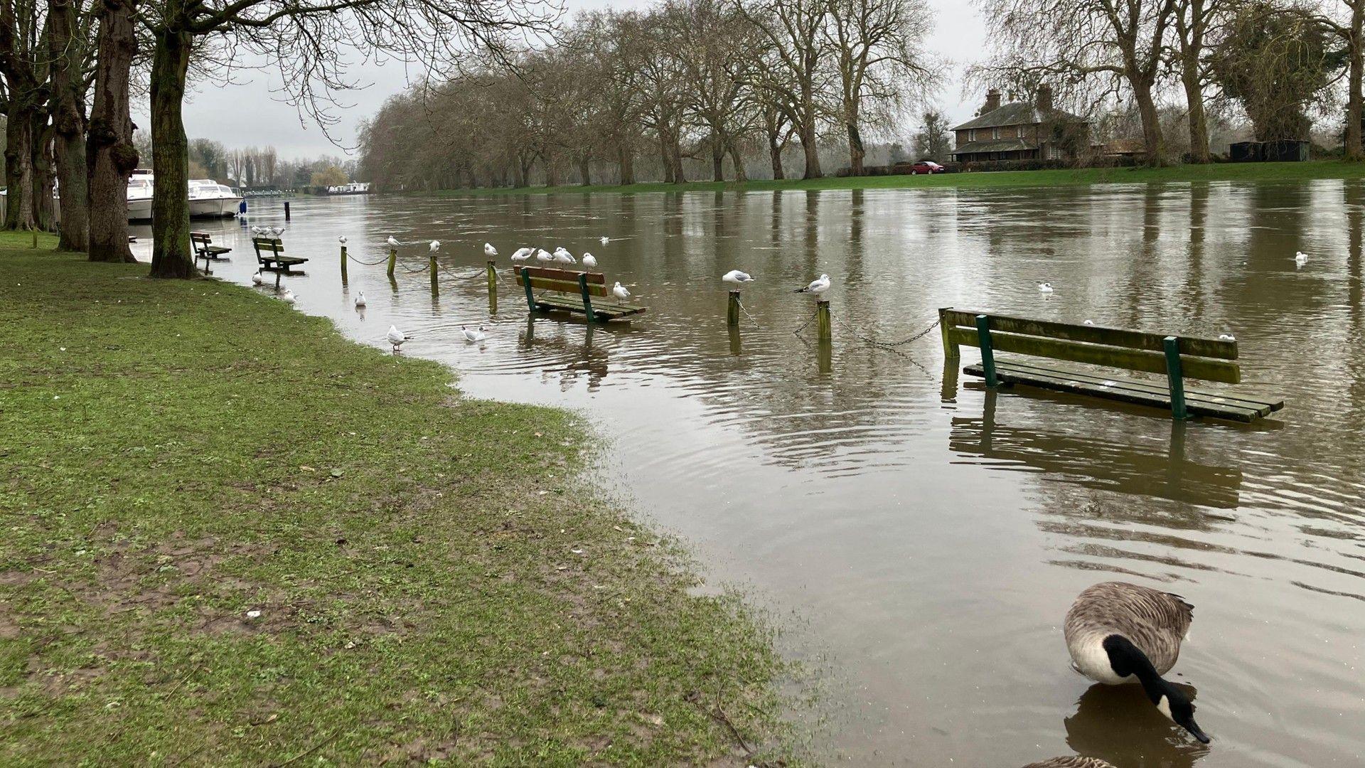 Image source, BBCWeatherWatchers/s Pace
Flooding in Datchet. A large number of flood warnings are in southern England
The persistence of the rain has led to the flooding many parts of the UK have experienced.
Parts of Cornwall have had rain falling on each of the last 50 days.
Katesbridge in Northern Ireland and Aboyne in Scotland have already had half a years rainfall in just a few weeks.
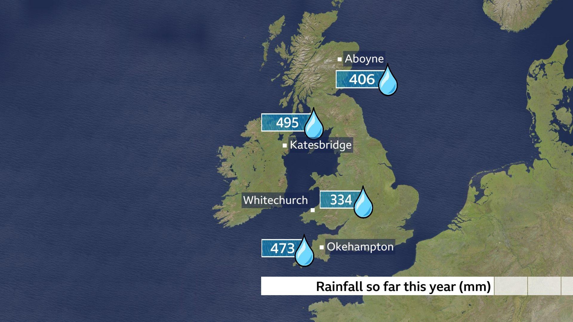
Wettest places in each home nation with rainfall totals all well above average
The predominantly south-westerly winds over the next few weeks will bring in spells of rain and areas of low pressure from time to time.
The wettest weather is expected to be over western hills. That means a change of fortune in Scotland, where up to now it has been extremely wet in eastern Scotland but drier than normal in the west of the country.
The recent snowfall will also melt rapidly as temperatures rise.
Given saturated ground in many parts of the UK and flood warnings, mainly in England, the risk of flooding will remain a concern well in to March.
You can find the longer range forecast here.