

 Image source, BBC Weather Watchers / june gothika
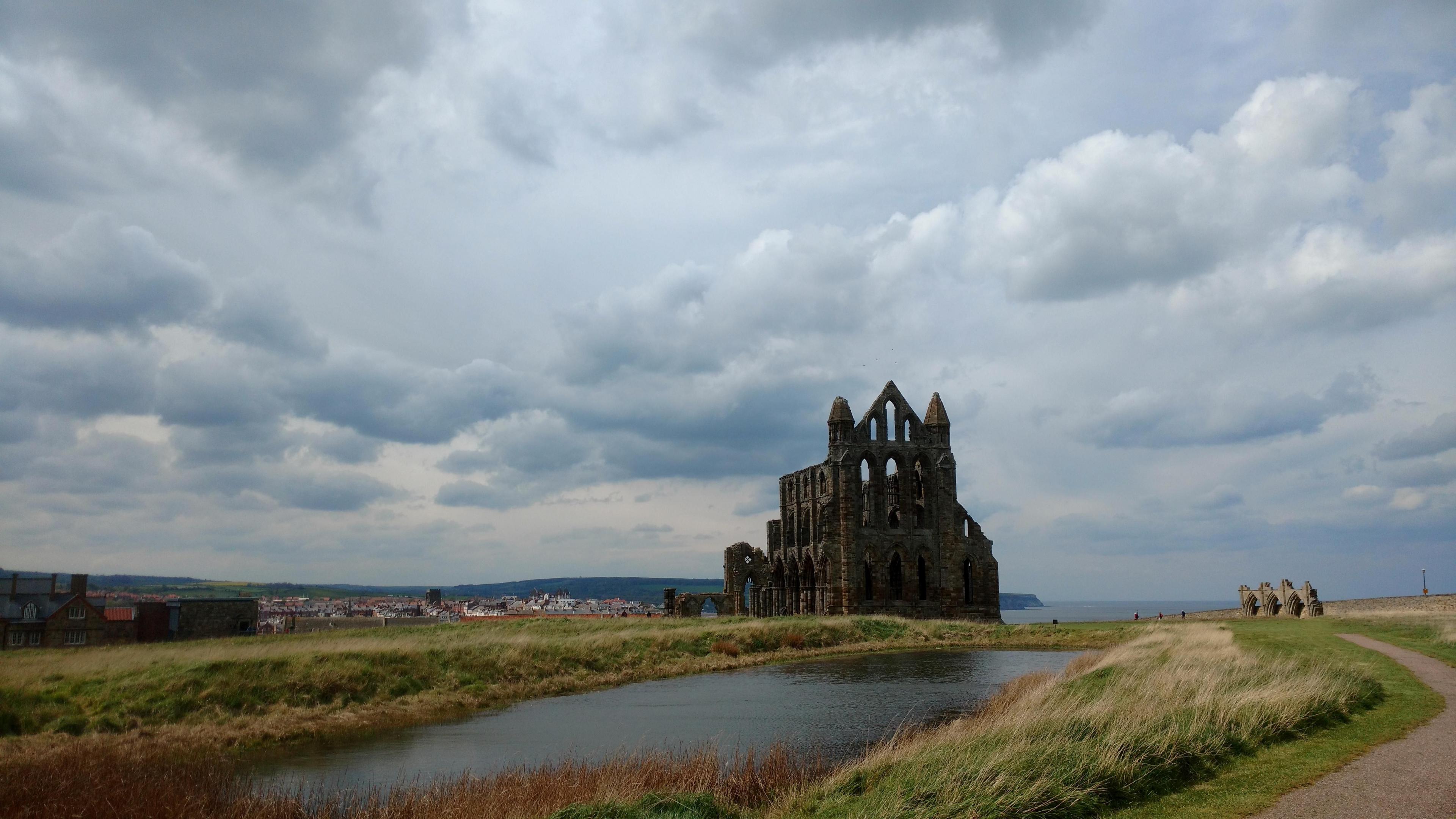
Another cloudy, grey day in North Yorkshire
Sarah Keith-Lucas
Lead Weather Presenter
Are you fed up with the gloomy skies and grey cloud? It's been lingering since last weekend across much of the UK and isn't shifting in a hurry.
Whilst the best of the sunshine has been in the west and north-west of the UK, most places have seen very limited brightness recently, as a thick layer of stratus cloud has been moving in on a chilly easterly breeze.
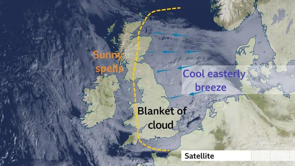
This satellite image shows the blanket of low cloud that's been rolling in across the UK from the east
Why is it so grey?
The jet stream is currently flowing quite far north of the UK. This pattern in the upper atmosphere has allowed a large, slow-moving area of high pressure to build over Scandinavia and has led to a cool airmass heading our way.
Whilst high pressure generally brings dry and settled conditions, it can also trap cloud and moisture - especially at this time of year when the winds are blowing over a cold North Sea.
This type of 'buckled' shape in the jet stream is known as a blocking pattern and it can slow or halt the progression of rain-bearing weather fronts, diverting them elsewhere.
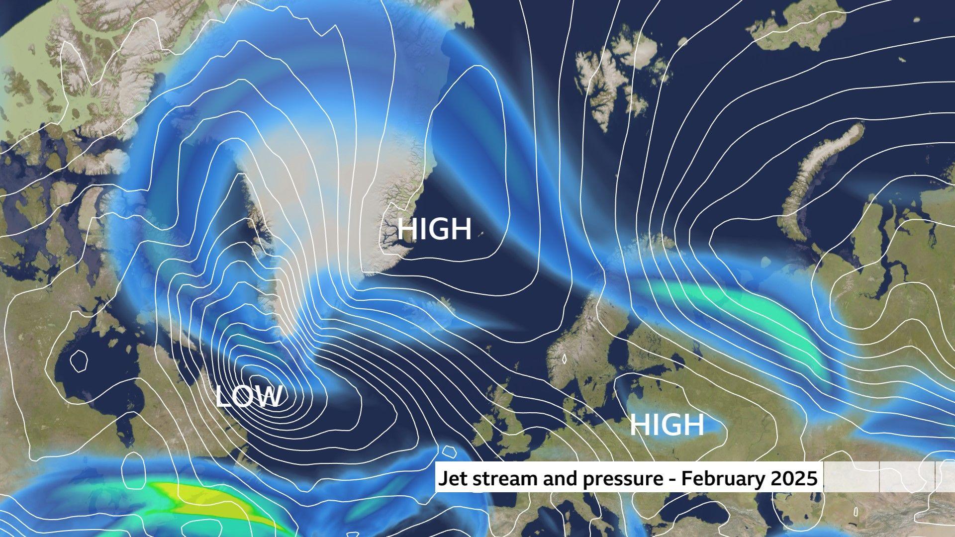 Image source, BBC Weather
A buckled jet stream is blocking low-pressure systems and preventing them from reaching the UK
Will it be sunny this weekend?
Whilst we expect the general pattern of chilly and mostly cloudy weather to continue for the next week or so - weather fronts may move in from the west later this week.
This could bring a little rain and hill snow to some western parts of the UK during Friday, potentially pushing into northern areas over the weekend. In the south however, a subtle change in wind direction may bring the chance of some long anticipated sunny spells.
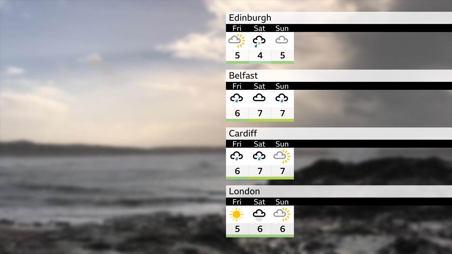
Outlook for Friday, Saturday and Sunday
How's the weather looking for the rest of February?
With just over two weeks left of meteorological winter, the weather is expected to stay slightly drier and colder than average for the next week or so, but there are signals for a return to milder and more unsettled conditions as we head towards the end of the month. More details can be found in the latest monthly outlook.