

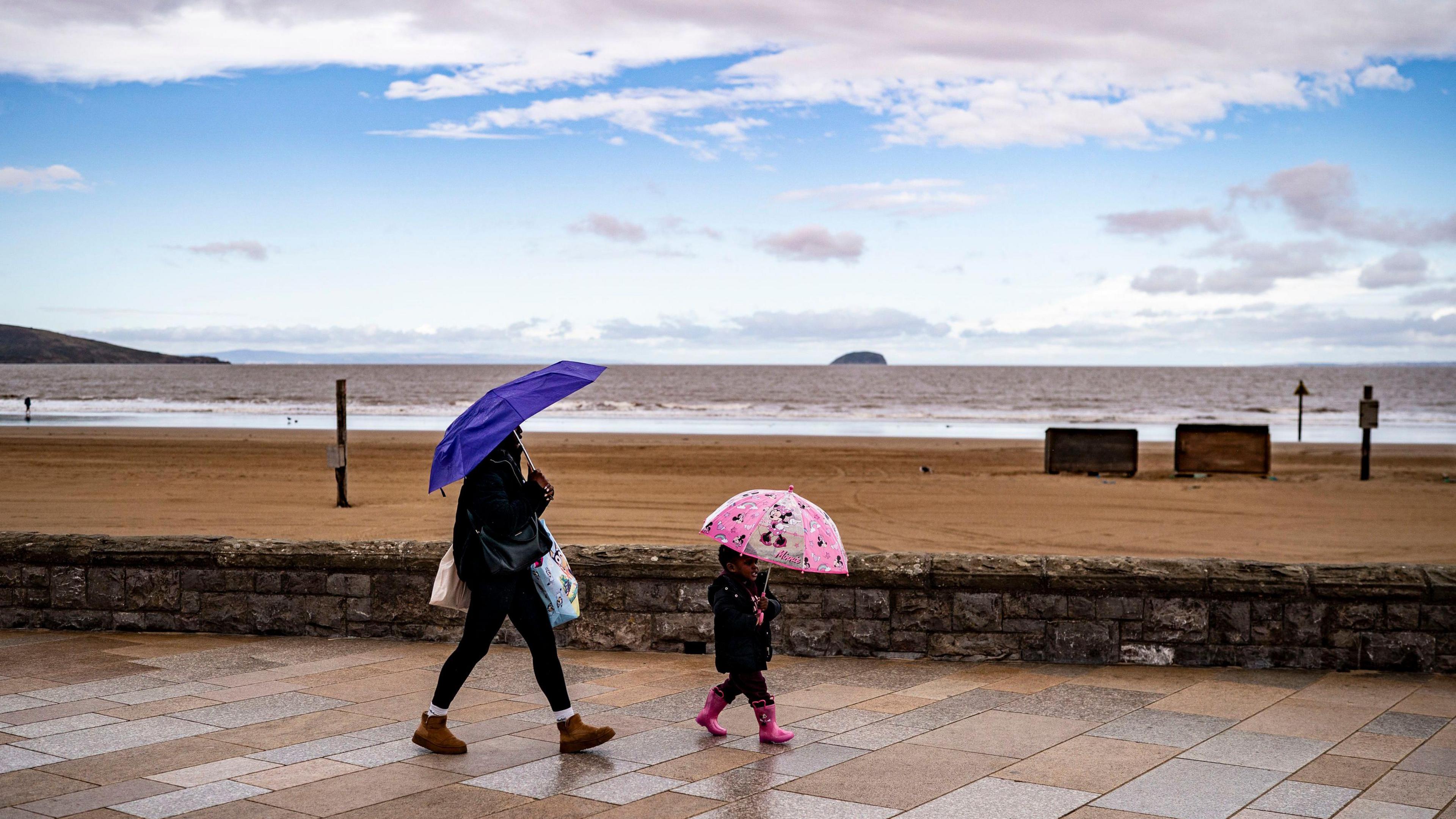
 Image source, Ben Birchall/PA Wire
ByBen Rich
Lead Weather Presenter
Cool westerly winds are returning to the UK, sweeping away this week's brief burst of spring warmth.
Parts of south-east England could reach highs of 22C (72F) on Thursday but other areas will see temperatures returning to around - or even below - the seasonal norm of 10-14C (50-57F).
Showers or longer spells of rain will affect many areas over the next few days with gales in places and the chance of snow over the highest ground in Scotland.
It comes after temperatures peaked at 26.6C at Kew Gardens, London, on Wednesday, making it the UK's warmest early April day in 80 years.
Rain returns and temperatures drop
An area of cloud will move eastwards across the UK during Thursday bringing sporadic outbreaks of rain - with a mix of sunshine and showers following from the west.
Hail and thunder may mix in with some of the showers, which could be wintry over hills and mountains in Scotland.
Parts of eastern and south-eastern England will remain mostly dry.
Westerly winds will bring cooler air from the Atlantic.
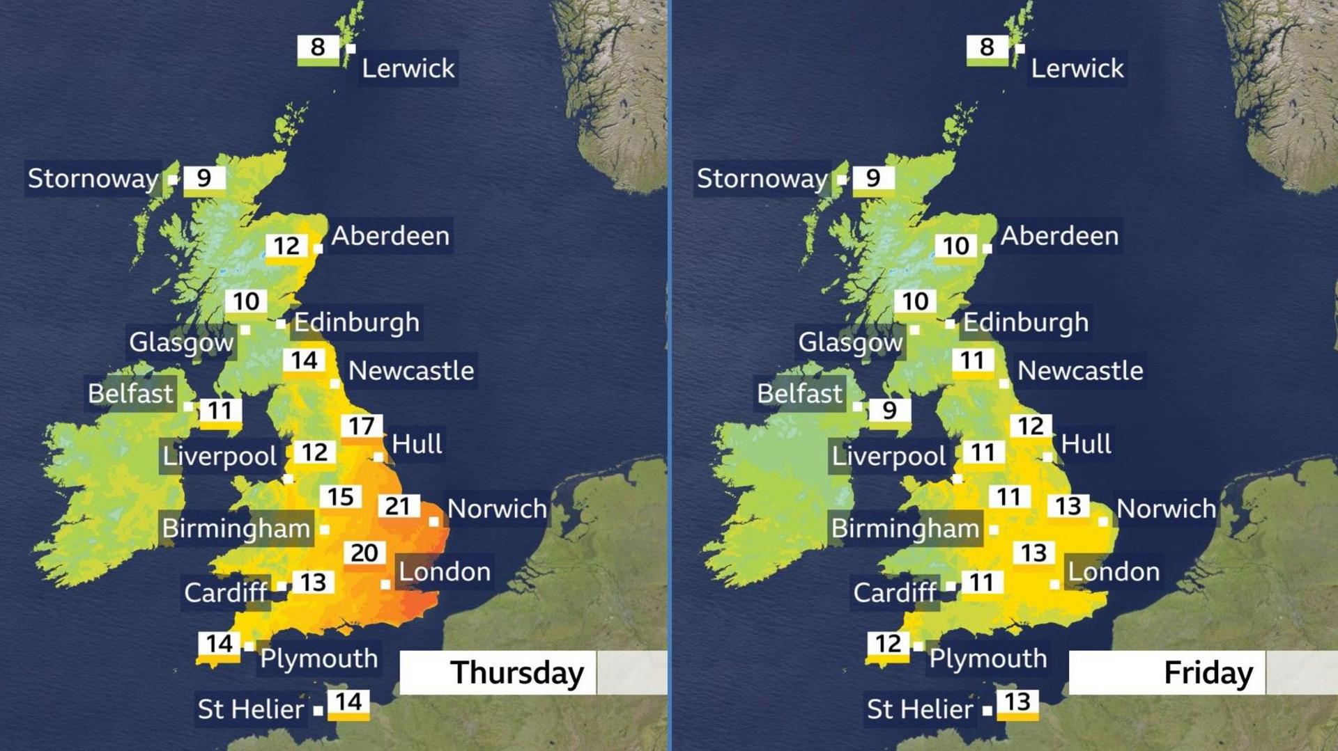
Temperatures will drop much closer to the UK April average of 10-14C (50-57F)
As skies clear and showers ease on Thursday night, temperatures will drop with some areas falling below freezing, especially in Scotland and Northern Ireland.
That will mean a frosty start for some on Friday morning.
Sunny spells will continue through the day for northern and eastern parts of Scotland and England, but cloud and patchy rain will spill in across western England, Wales and eventually south-west Scotland.
Northern Ireland will turn thoroughly wet with heavy rain on Friday afternoon.
Winds will strengthen with gusts of 50-70mph (80-129km/h) around some coasts of Northern Ireland and western Scotland.
Low pressure will dominate the weather over the weekend, with gales possible in some northern and western parts of the UK.
Showers or longer spells of rain will affect most areas at times but with lengthy dry and bright spells in between, especially towards the south and east of the country.
That will mean pollen levels remain high or very high in many areas of England.
There is nothing strange or unusual about the weather that is heading towards the UK over the next few days - it just marks a return to normal spring conditions.
It is the temperatures we have had over the last couple of days that have been out of the ordinary, in some cases more than 10C (18F) above the seasonal average.
26.6C (79.9F) at Kew Gardens on Wednesday was the second-highest temperature recorded in the UK during the first half of April.
It was just a fraction below the 26.7C (80.1F) recorded at Greenwich, London, on 4 April 1946.
The warmth came courtesy of a flow of southerly winds from continental Europe.
Temperatures climbed abruptly, building over just a couple of days to give all four nations of the UK their warmest weather of the year so far.
Climate change may also have played a part, making an already warm spell even warmer than it might have been in a pre-industrial world.
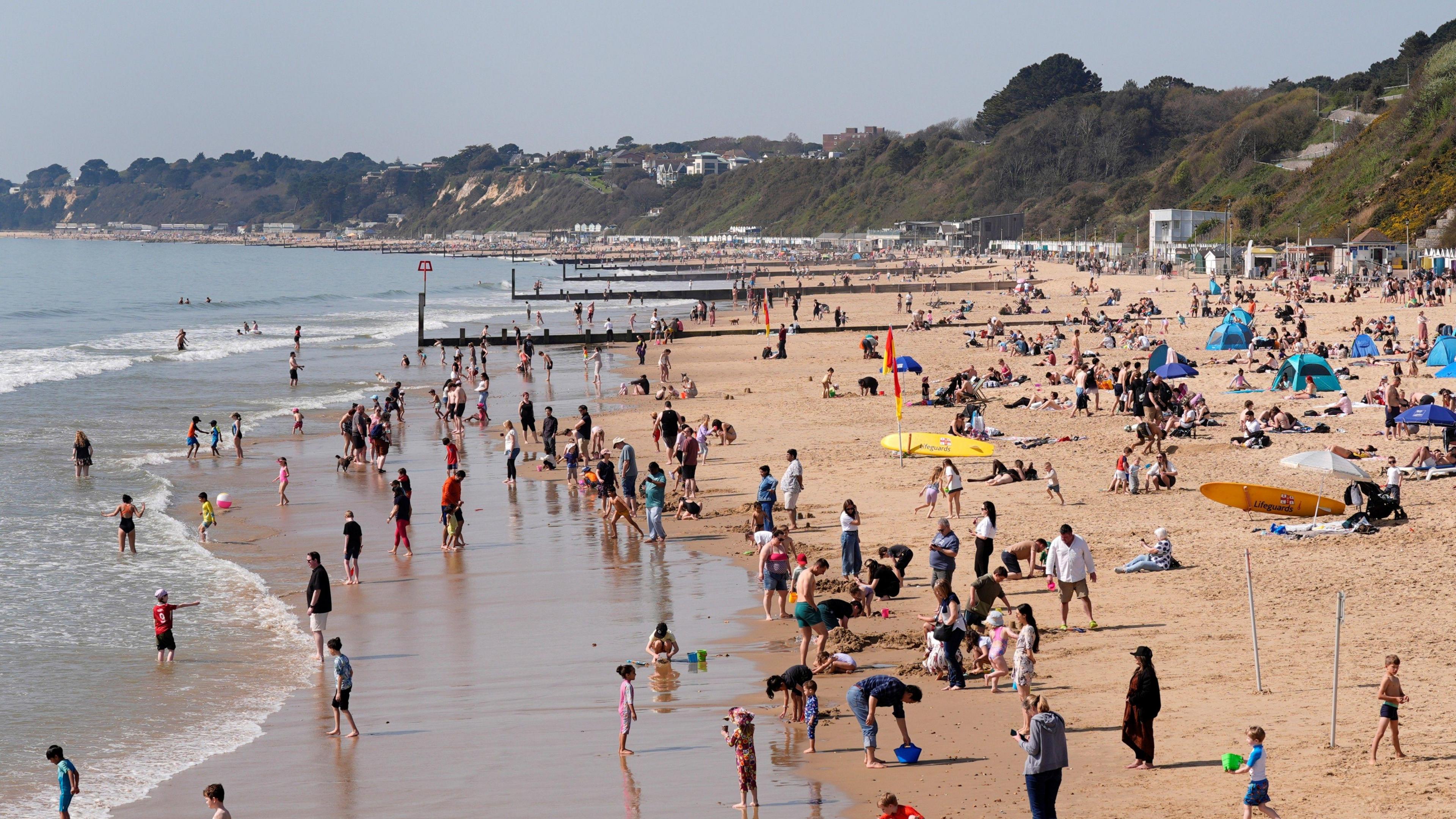 Image source, Andrew Matthews/PA Wire
People flocked to Bournemouth beach on the warmest day of the year so far
After a cool start to next week temperatures are then expected to climb a little, albeit with some outbreaks of rain at times.
At this stage there is no sign of a return to the exceptional warmth of the last few days but there are uncertainties amongst computer forecast models - so the details may change.
You can keep up to date with your local forecast on the BBC Weather website and app, and check the longer term prospect with our monthly outlook.